Projects: Every Site in Its Own Workspace
Creating projects in CartaX, the quick actions on a project card, content icons, returning to your last project where you left off, and project counts per plan.
2026-09-20 · 5 min read
A project is the workspace where all the data for one site or job comes together on a single map: orthophotos, point clouds, 3D models, 360° imagery, vector drawings, measurements and notes. Every file you upload lives inside a project, and shares are created from projects too.
A new project needs only a name
On the projects page you press the + button at the bottom right, type a name and hit Enter. No location, no date, no other settings — the preview and content icons fill themselves in as data arrives.
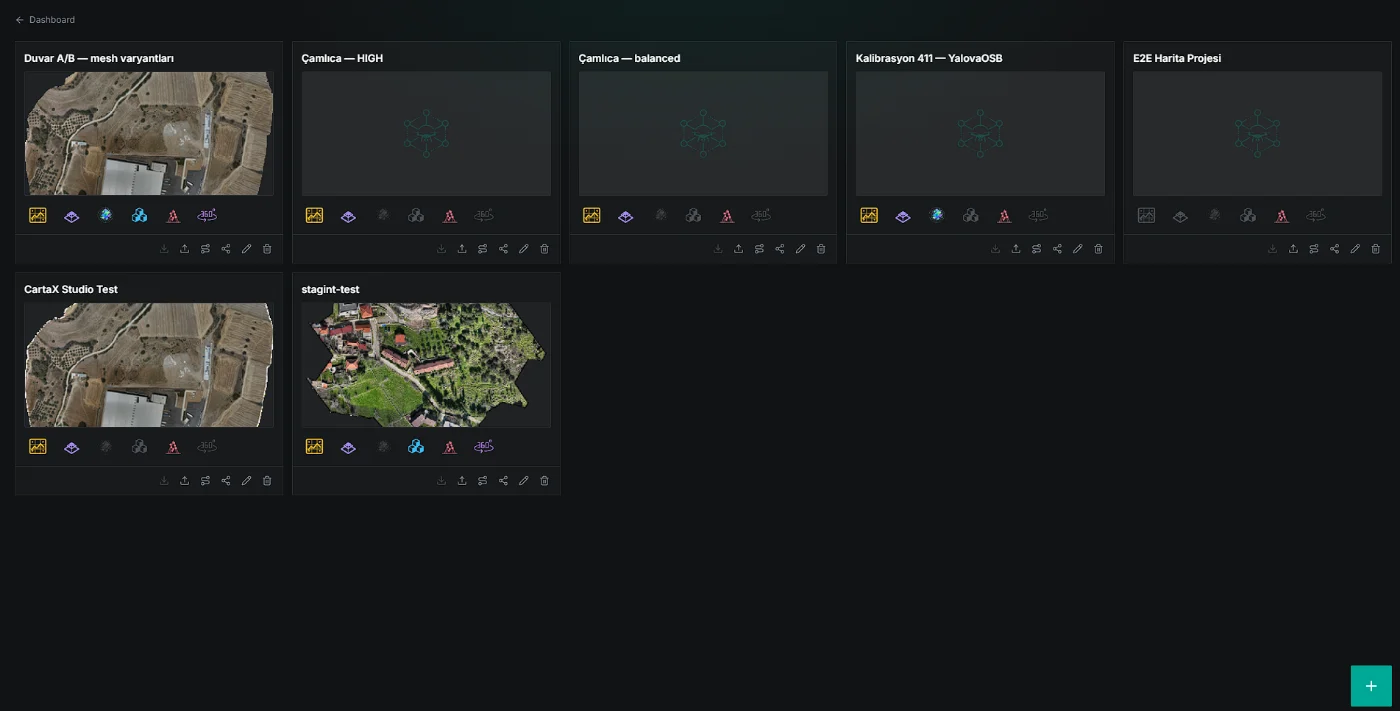
Opening a separate project per site or job keeps data from mixing: one site's monthly flights in one project, a parcel's survey in another.
| Plan | Projects |
|---|---|
| Free | 1 |
| Professional | 100 |
At the limit the + button dims and reads "Project limit reached", with a reminder note at the bottom of the page. Deleting a project frees a slot. Projects cannot be foldered, tagged or filtered; the list is sorted newest first. There are no project templates and no duplication.
The project card and its quick actions
Every project is a card: its name, a preview, icons for the data types inside it, and six quick actions underneath. The preview comes from an orthophoto in the project; without one you see the CartaX icon.
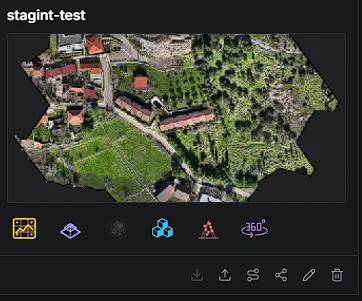
| Action | What it does |
|---|---|
| Download | Not active yet; the button appears dimmed |
| Upload | Opens the upload window for the project |
| Create route | Starts a route targeting data in the project |
| Share | Opens the PIN-protected sharing window |
| Rename | Makes the name editable on the card; Enter or clicking away saves, Esc cancels |
| Delete | Asks for confirmation, then removes the project and all its data permanently |
Clicking the card opens the project on the map and moves it into the Last project area on the dashboard.
Content icons: what's in the project, at a glance
The six icons under a card — and under the dashboard's Last project area — tell you which data types the project holds. Present types are coloured, absent ones dimmed; an asset in an error state is not counted.
| Icon | Meaning |
|---|---|
| Orthophoto | A processed, ready-to-use orthophoto |
| 3D Tiles | A textured 3D model of a wide area |
| 3DGS | Gaussian Splat: a photorealistic 3D scene (outdoor or indoor) |
| GLB | A single-piece 3D object model placed on the map |
| Point cloud | 3D survey data describing terrain with millions of points |
| 360 | A 360° photo or video collection |
Last project: pick up where you left off
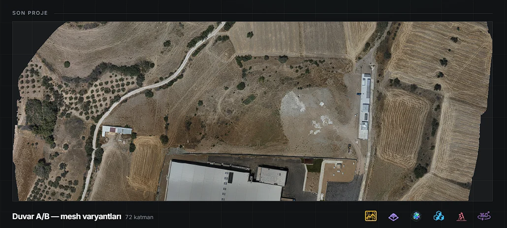
Last project is tied to your account, not to a device: open on your desktop, and your phone shows the same project. When you reopen it, the view you were last looking at and the layers you left open come back; if you open it through a note or asset link, the camera goes straight to that target.
This view is personal — it does not change what your colleague sees. It is not remembered in a project opened through a share link.
The number next to the name is the project's layer count (e.g. "72 layers"). Renaming a project updates it here too; deleting one empties the area. If you have never opened a project it says "No project opened yet" and offers a Go to projects button.
Routing from a card, without typing a destination
The route button on a card starts a route targeting data in the project in two clicks — the destination comes from that data's position on the map.
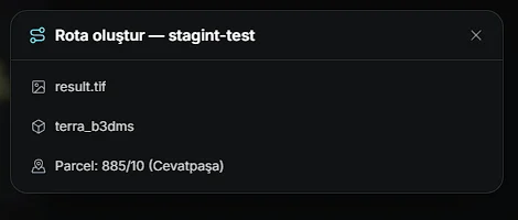
| Data | Destination point |
|---|---|
| Orthophoto | Centre of the area the orthophoto covers |
| KML (e.g. a parcel boundary) | End of the line if there is one; centre of the area otherwise |
| 3D model (3D Tiles) | Centre of the model — point clouds with 3D Tiles output are listed here too |
360° imagery and GLB models cannot be chosen as destinations. See Route planning.
FAQ
| Question | Answer |
|---|---|
| How many projects can I create? | Free 1, Professional 100 |
| Can I put projects in folders? | No; the list is sorted newest first |
| Does creating a project open it? | No; the card appears in the list and you click to open it |
| Can I undo deleting a project? | No; the project and its files are removed permanently |
| Why doesn't the Download button work? | It is not active yet |
| Will I see the same project on my phone? | Yes; last project is tied to your account |