The Layer Panel and Map Screen: 2D and 3D Switch Themselves
How CartaX groups layers by type, why the map moves between 2D and 3D on its own, what sub-layers do, and what the compass, coordinate box, live location and corner settings give you.
2026-09-20 · 8 min read
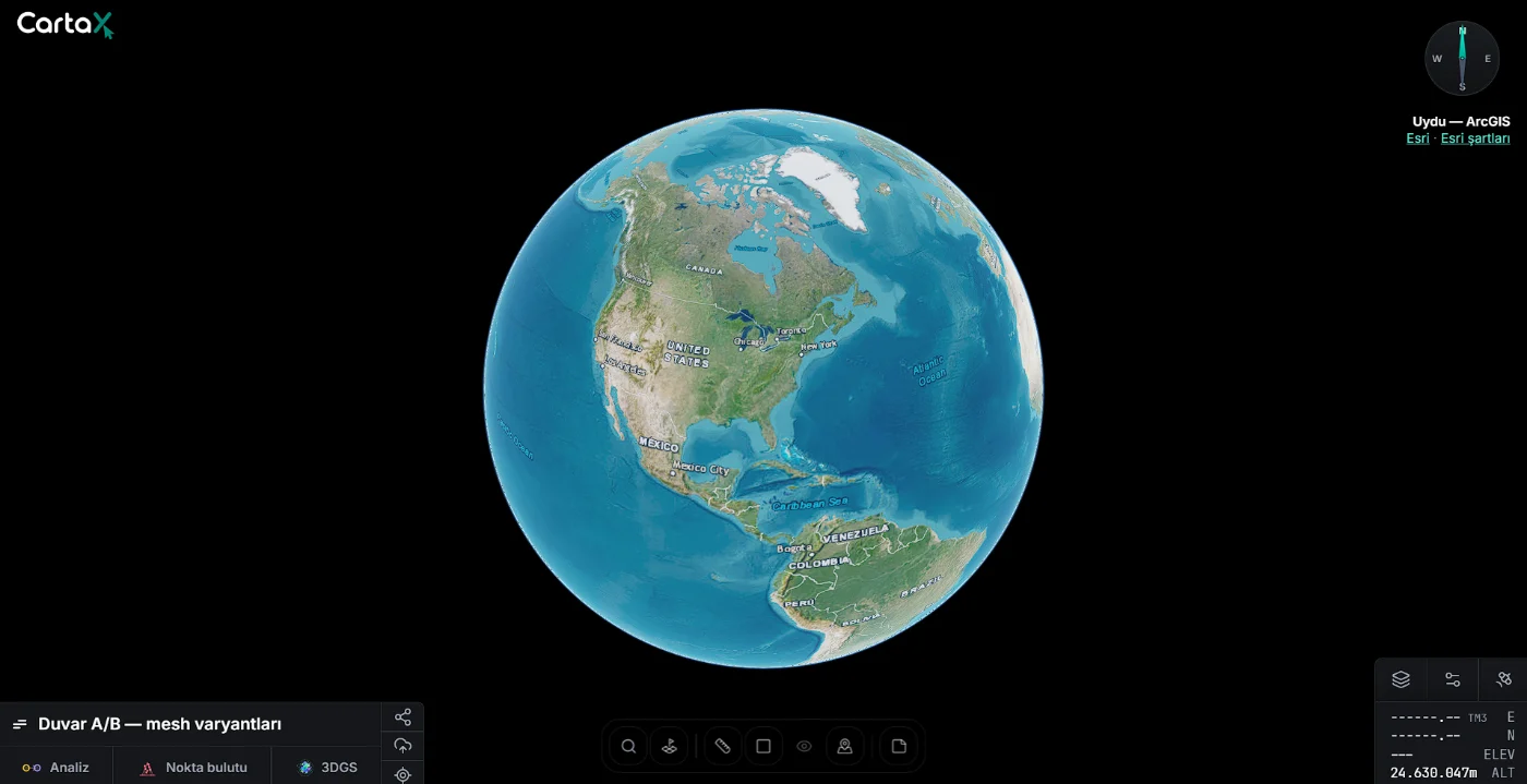
There are no two maps in CartaX. There is a single globe, and every piece of data on it — orthophoto, 3D model, vector drawing, 360° collection — is a layer. This guide covers how layers are managed, why the map moves between a flat plan and a terrain-backed 3D view by itself, and what the controls in the corners of the screen do.
The layer panel: groups build themselves
The panel on the left groups every layer in the project by type. You never create folders or sort anything; each group shows how many layers it holds and an eye icon that shows or hides the whole group at once. Empty groups do not appear at all — a project only lists the groups for the types it actually contains.
| Group | What's inside |
|---|---|
| Orthophoto | Orthophoto layers |
| 360 / Panorama | 360° photo and video collections |
| 3D Tiles | Textured 3D models |
| Gaussian Splat (3DGS) | 3DGS models placed on the map |
| GLB Model | GLB models not attached to a 3D model |
| Parcel Queries | Cadastral parcels queried from the map |
| Vector | GeoJSON, KML/KMZ, Shapefile, DXF and NCN drawings |
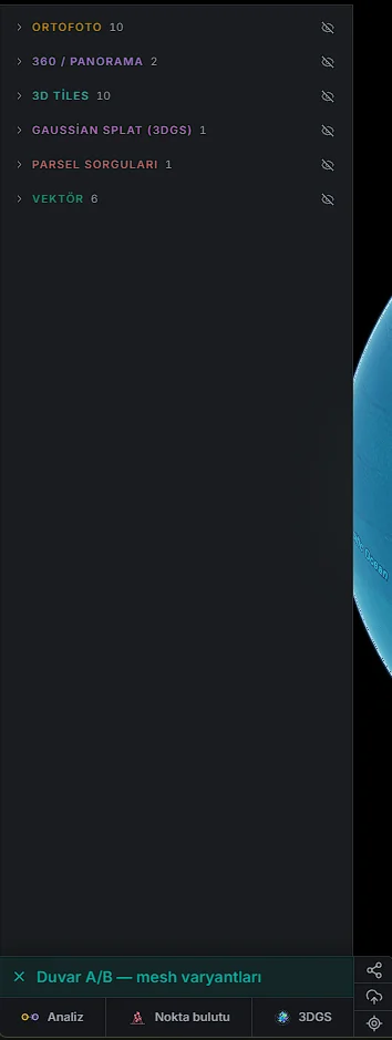
Layer status is readable in the row itself: Uploading, Processing, Generating COG…, Error. When a parent layer is hidden, its attached layers show an "Parent layer hidden" notice.
Three things are deliberately not in the panel. Point clouds, indoor 3DGS scenes and the analysis workspace are not listed; they open in their own full-screen viewers via the Point cloud, 3DGS and Analysis buttons in the strip at the bottom of the panel. If the project has no such data the button stays inactive, and Analysis does not appear at all on the Free plan.
Why the map switches between 2D and 3D by itself
An orthophoto is a flat photograph of the ground and reads correctly from directly above. A 3D model only means something with its height, and has to sit at the terrain's real elevation. CartaX does not let the two overlap and obscure each other: whichever you open, the map moves to the view that suits it.
| Layer you open | Map | Side effect |
|---|---|---|
| 3D Tiles model | 3D | Orthophotos close |
| GLB model | 3D | Orthophotos close |
| 3DGS map model | 3D | Orthophotos close |
| Orthophoto | 2D | 3D models and point clouds close |
| Vector · 360 | unchanged | Closes nothing; stays in either view |
The difference between the views is the camera: in 2D it looks straight down and cannot tilt, while panning and zooming stay free. In 3D terrain elevation is enabled and the camera tilts and rotates freely.
You can also choose manually: the Base map and surface button at the bottom right has a 2D / 3D switch — useful, for example, to look at an orthophoto together with the terrain. A manual choice holds until you select another layer; after that the map decides by type again. Every project opens in 2D.
Layer actions
The menu in a layer row opens that layer's actions. The buttons differ by type — each type shows only what makes sense for it, so you never meet a meaningless button.
| Type | Buttons |
|---|---|
| Orthophoto | Rename · Share · Create route · Analysis · Settings · Delete |
| 3D Tiles | Rename · Share · Create route · Inspect · Analysis · Settings · Quality · Delete |
| 3DGS map model | Rename · Share · Inspect · Settings · Edit position · Delete (plus "Remove from map" once placed) |
| GLB model | Rename · Share · Settings · View · Delete |
| Vector · Parcel | Rename · Style · Geometry · Share · Delete — Geometry is absent on parcels |
| 360 collection | Rename · Share · Add · Delete |
Rename changes the layer name. Settings opens type-specific settings. Inspect isolates a model for close-up viewing (desktop). Analysis adds the layer to — or removes it from — the analysis workspace; it does not open the comparison. View opens a GLB model in a separate 3D window.
Deletion cannot be undone. Delete asks for confirmation and then removes the layer permanently, along with its uploaded files, processed outputs and any 360° videos. There is no trash and no restore.
Sub-layers and measurements
Work done on top of an orthophoto or a 3D model collects underneath that layer:
- Measurement target — written under the selected layer; new measurements are saved here. The × next to it clears the selection. Only orthophoto and 3D Tiles layers can be measurement targets.
- Measurements — everything measured on that layer; each can be hidden, restyled, edited or deleted.
- Sub-layers — parcels queried on top of this layer and GLB models placed on it.
- Classes — on orthophotos with class output: buildings, roads, vegetation and so on with their areas and lengths.
Hiding a parent layer also removes all of its measurements and sub-layers from the map. Reopening the layer returns each of them to its own previous state: a measurement you had hidden stays hidden, the visible ones come back.
Controls in the corners
On desktop, map settings live in three buttons at the bottom right. On phones the base map, 2D/3D and external-layer controls all open from a single settings button.
| Button | What's inside |
|---|---|
| Base map and surface | Base map (Carto · Esri Satellite) and the 2D / 3D surface mode |
| View settings | Terrain exaggeration (0.5× – 3×) and Smooth mode |
| External layers | WMS / WMTS / TMS services: add, show, hide, opacity |
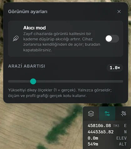
Terrain exaggeration makes a slope or a valley legible on ground that looks flat; 1× is true scale. This setting is visual only — measurements and elevation profiles always use the real elevation.
Smooth mode drops render quality one notch on weaker devices to keep the view fluid. If the device struggles, CartaX turns it on by itself and says so on screen; you can turn it off from View settings.
Every project opens with Esri Satellite as the base map. Guests on a share use the same corner buttons but cannot add external layers, and their base map and view changes are not saved.
Compass, coordinate box and live location
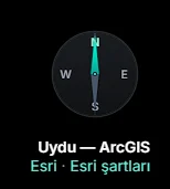
The compass shows which way the map faces; clicking it rotates the map to north while keeping your position and tilt. Underneath it the source of the current base map is credited — "Satellite — ArcGIS" on Esri Satellite, OpenStreetMap and CARTO on Carto — with a link to the terms of use.
The coordinate box reads the point under your cursor live:
| Row | What it shows |
|---|---|
| E / N or LAT / LON | Coordinate of the point under the cursor; in TUREF TM and UTM the zone name follows (e.g. TM30) |
| ELEV | Height of the surface under the cursor — terrain or 3D model |
| ALT | Height of the camera, i.e. your viewpoint |
Clicking the box cycles the display WGS84 (lat/lon) → TUREF TM → UTM, and your choice is remembered on that device. Visitors from Türkiye start on TUREF TM with the zone selected automatically. In 2D on flat ground, height is unknown outside a model, so ELEV reads ---. These values are a live readout; for a saved elevation use the Point tool.
Live location sits on the right rail. The browser asks for permission; once the first fix arrives the map comes to you from 1,200 m up in a top-down view and follows your position, drawing an accuracy circle around it. Panning or zooming by hand stops the following; a small button appears to re-centre. Pressing the location button a second time turns live location off. Your location is not stored and not shared.
FAQ
| Question | Answer |
|---|---|
| Can I reorder layers manually? | No; grouping happens by type automatically |
| Can I see an orthophoto and a 3D model at once? | No; opening one closes the other — vector and 360 stay in both |
| I switched to 3D and it reverted | A manual choice holds only until you select another layer |
| Why isn't the point cloud listed? | It opens in its own viewer, from the Point cloud button in the bottom strip |
| Does terrain exaggeration change measurements? | No, only the picture |
Why does ELEV read ---? |
In 2D on flat ground, height is unknown outside a model |
| Can I undo a layer deletion? | No; deletion is permanent |